


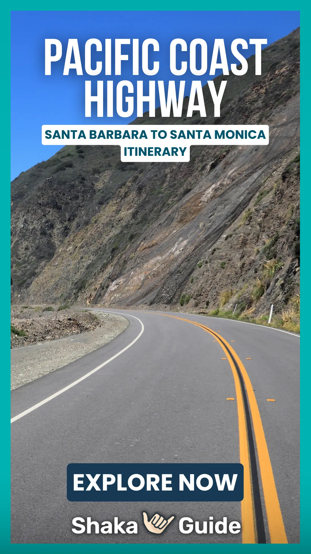
Shaka Guide's Pacific Coast Highway: Santa Barbara to Santa Monica Itinerary

Join us for sand, surf, and sunshine as Shaka Guide takes on the Pacific Coast Highway.
This tour is one of four Shaka Guide tours that explore the Pacific Coast Highway between San Francisco and Los Angeles.
This tour stretches between Santa Barbara and Santa Monica, exploring Malibu and the American Riviera.
Along the way, we celebrate the joy of the beach and take you to historic piers, exciting hikes, and iconic movie locations.
There are 14 stops on the tour, which works going in either direction. If you're heading southbound, our tour ends as you approach the famous Santa Monica Pier.
- Stearns Wharf
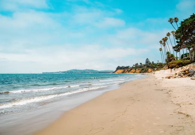
- Butterfly Beach
- Carpinteria State Beach
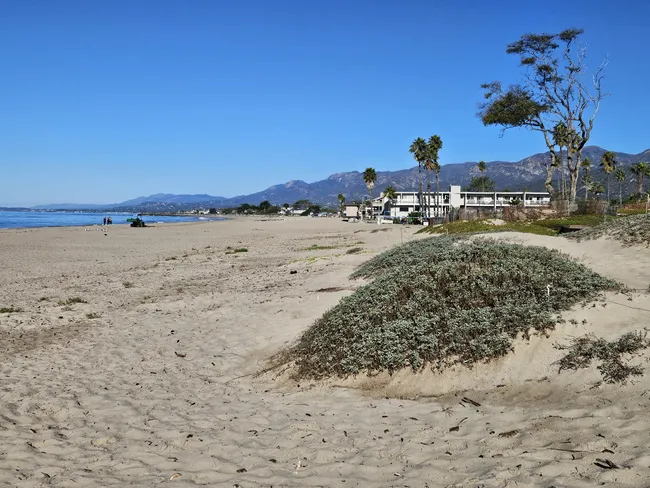
- Carpinteria Bluffs Nature Preserve
- Mugu Rock
- Neptune's Net
- Leo Carrillo State Beach
- El Matador State Beach
- Westward Beach
- Point Dume
- Escondido Falls Trailhead
- Solstice Canyon Trailhead
- Malibu Lagoon State Beach
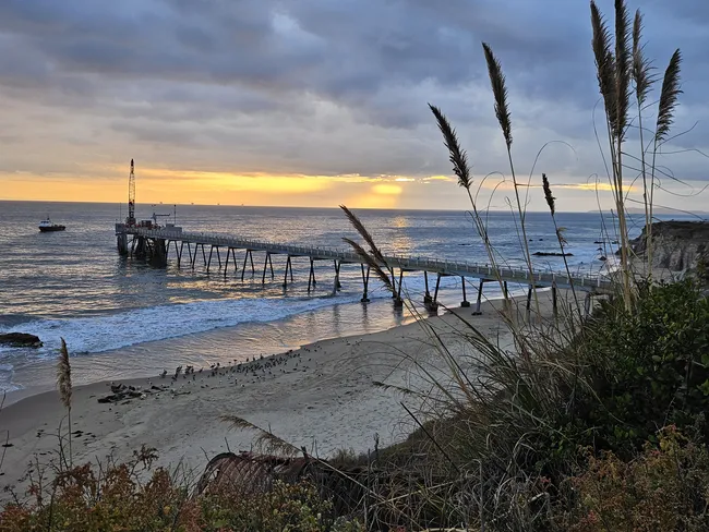
- Malibu Pier
The following itinerary starts in Santa Barbara and heads southeast, ending in Santa Monica.
Many beaches require a fee to park. However, state beaches share the same fee. If you park at one, you can display your parking pass on the dashboard for the others.
If you're planning on stopping at more than one, then buying a day pass at the first state beach you visit is a good idea.
Itinerary
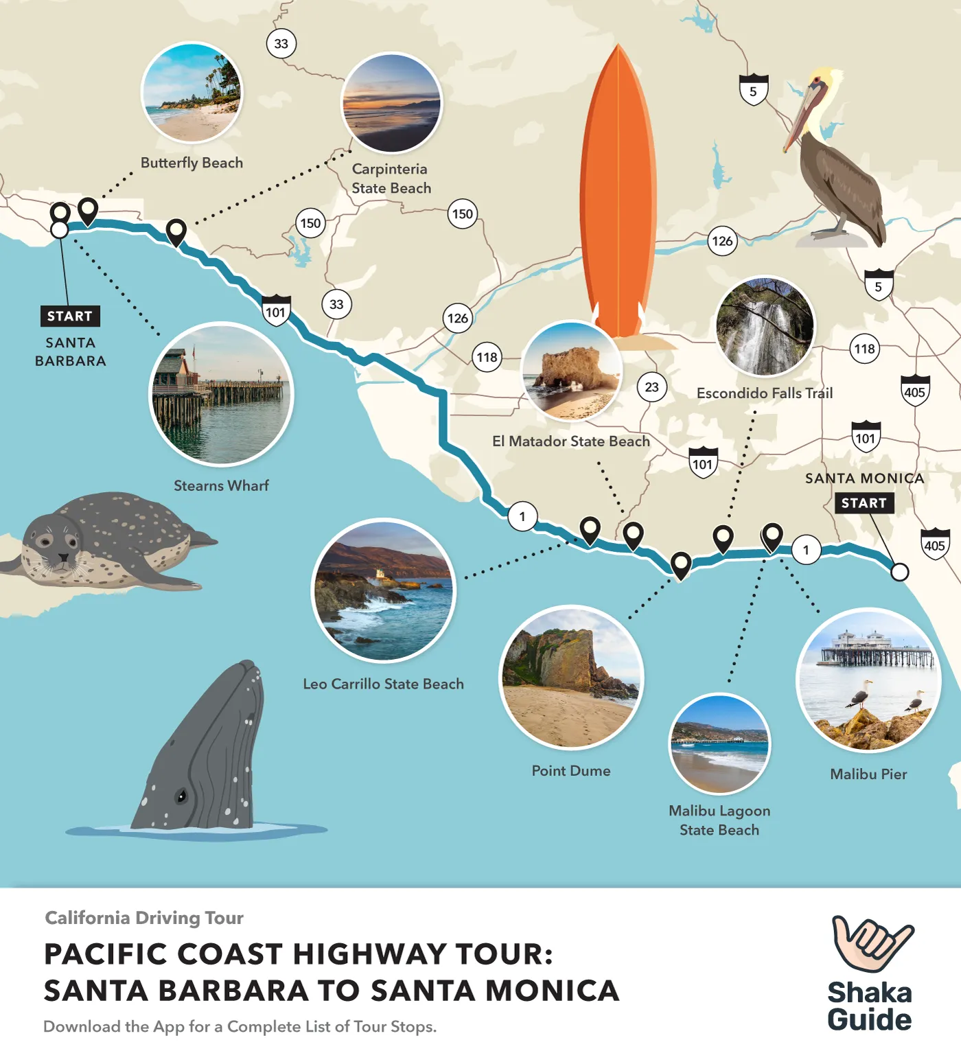
1. Stearns Wharf
 Matt Caracciolo
- Duration: 1 hour
Stearns Wharf is located in the Santa Barbara harbor. Dating back to 1872, it's the oldest working wooden wharf in California, and one of the longest.
There are restaurants, scenic overlooks, places to fish, beach access, and a natural history museum.
The views from the wharf of the city and the Santa Ynez Mountains behind it are spectacular.
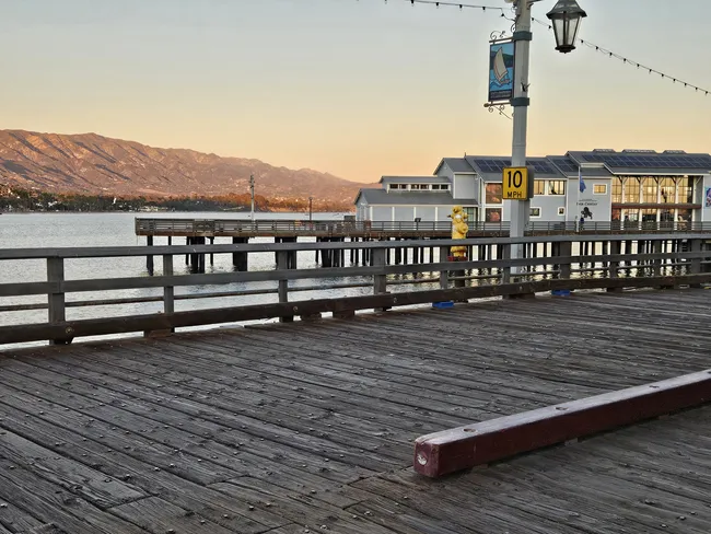
2. Butterfly Beach
 Matt Caracciolo
- Duration: 30 minutes
This quiet beach is located within the chic and luxurious village of Montecito, which is home to several celebrities. So you never know who you'll bump into!
Walk along the top of the cliffs, or find a set of stairs to reach the beach below. There are no public facilities. Park on either side of Channel Drive.
3. Carpinteria State Beach
 Matt Caracciolo
- Duration: 45 minutes
Carpinteria Beach is known as a family-friendly beach, with gentle waves and a wide, shallow area to enjoy the sand. Parking is free in town nearby, which has lots of restaurants and shopping. Restrooms are available.
4. Carpinteria Bluffs Nature Preserve
 Matt Caracciolo
- Duration: 30-60 minutes
This nature preserve features easy trails to the Carpinteria Bluffs and a rookery of harbor seals. The hike from the parking lot to the harbor seal rookery is about one mile round trip, all across easy, flat ground.
When you reach the ocean, turn right and continue towards an old pier. The seal rookery is close to the pier. To see the tar pits, continue along the path, and add about another mile round trip.
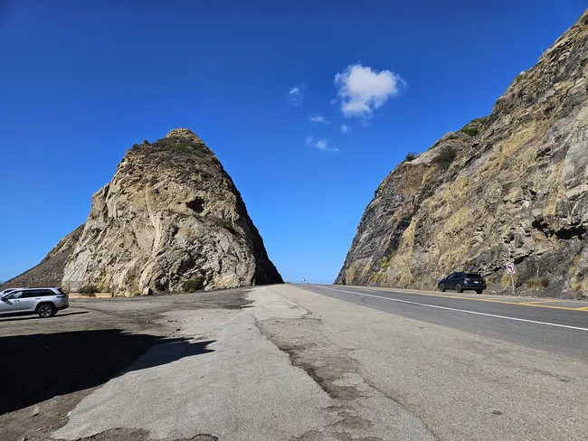
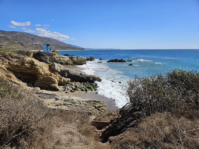
5. Mugu Rock
 Matt Caracciolo
- Duration: 10 minutes
When construction crews were building the Pacific Coast Highway, they blasted right through the middle of a hill right next to the ocean, splitting it in half.
The half by the water creates a unique shape at Mugu Point, and an interesting place to get out of the car and explore.
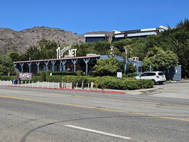
6. Neptune's Net
 Matt Caracciolo
- Duration: 1 hour
This touristy but famous seafood and grill restaurant right along the PCH has been featured in several movies.
Prices are reasonable, and County Line Beach is right across the street. This iconic beach is referenced in the Beach Boys' song Surfin' USA.
7. Leo Carrillo State Beach
 Matt Caracciolo
- Duration: 45 minutes
Leo Carillo has a wide, sandy beach perfect for swimming, surfing, and lounging in the sand.
Additionally, there is an interesting rocky area to explore, with cliffs and sea caves. The opening sequence of Grease was filmed here.

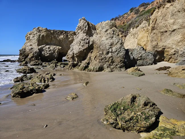
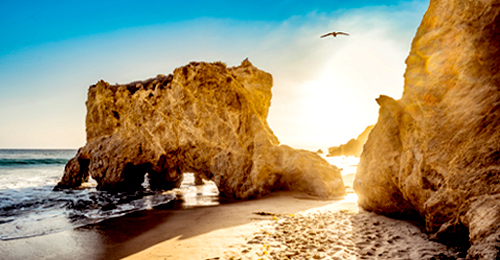
8. El Matador State Beach
 Matt Caracciolo
- Duration: 30 minutes
Part of Robert H. Meyer Memorial State Beach, El Matador is a pocket park with cool rock formations and sea caves.
It's a short but steep walk from the parking lot to the beach. There's a small parking lot with paid parking.
Otherwise, park for free on the Pacific Coast Highway. Restrooms are available.
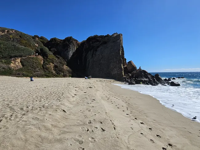
9. Westward Beach
 Matt Caracciolo
- Duration: 45 minutes
Westward Beach is directly below Point Dume, and just to the west. With Point Dume dramatically standing next to it, the beach is an exciting place to explore.
Climb around the point to the secluded Pirate's Cove behind the cliffs. You can also hike from the beach to the top of Point Dume.
The trail is about 1 mile round trip and considered moderate, with some considerable incline. Restrooms are available.
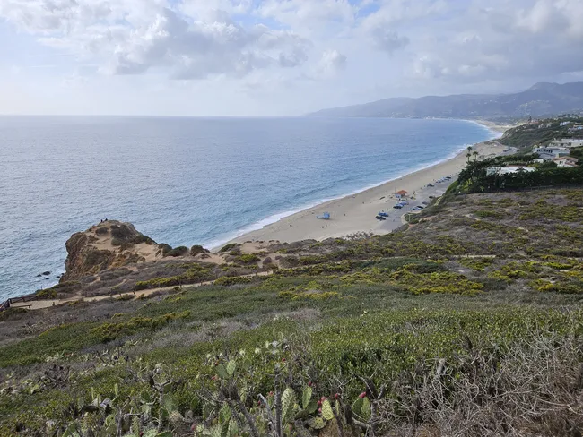
10. Point Dume
 Matt Caracciolo
- Duration: 45 minutes
Point Dume is one of the most dramatic overlooks along the Pacific Coast Highway! Around two miles of trails crisscross this prominent point overlooking the ocean and the secluded beaches below.
Multiple Hollywood movies have been filmed here, including some very iconic moments. Parking is free but limited.
Parking is more plentiful at Westward Beach below. To hike between the two, the trail is about a mile round trip with some moderate incline.
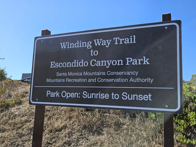
11. Escondido Falls Trailhead
 Matt Caracciolo
- Duration: 2-3 hours
Escondido Falls is an unusual waterfall, with a mossy 'beard' hanging over the drop. The trail is 3.5 miles round trip and moderately difficult.
The first mile is an uphill path along the paved Winding Way road, going past mansions.
Then, the Escondido Canyon Trailhead is easily visible with a big brown sign.
The rest of the trail is partially shaded, with some small water crossings. There are actually three waterfalls, with the first the easiest to reach. No restrooms available.
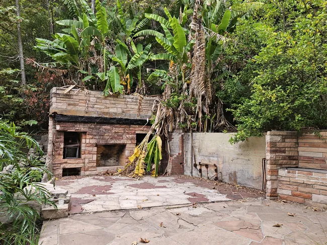
12. Solstice Canyon Trailhead
 Matt Caracciolo
- Duration: 2 hours
This 3-mile loop is mostly shaded and passes a small waterfall, as well as the ruins of some historic homes that were the victims of a wildfire.
The trail is paved for about a half mile and is mostly easy, except for a steep climb up the ridge.
It's easy to turn around and avoid the steep part altogether, and make this an out-and-back hike.
Otherwise, the entire loop is moderately difficult. Restrooms are located 100 feet up the trail.
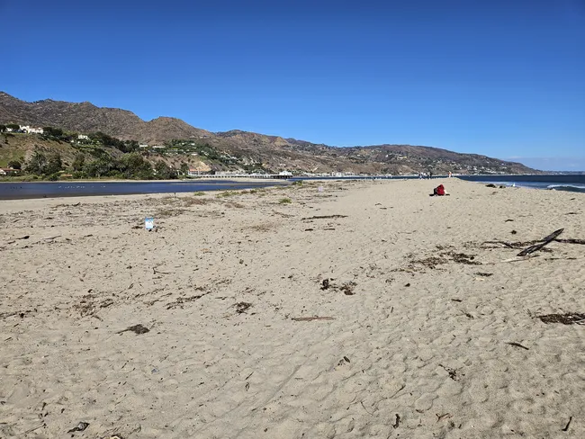
13. Malibu Lagoon State Beach
 Matt Caracciolo
- Duration: 30 minutes
This beach is adjacent to Malibu Pier and is a popular surfing destination. Within the park is the Adamson House overlooking a short bluff.
The house is open for tours and features historic, local ceramic work. There's also an adjacent local history museum.
The park is located next to the Malibu Movie Colony, where celebrities are known to keep vacation homes.
Across the lagoon from the Adamson House is another parking area and a path to another beach next to the homes.
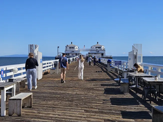
14. Malibu Pier
 Matt Caracciolo
- Duration: 30-60 minutes
This popular landmark attracts people from all over for its scenery, restaurants, and fishing. Rentals are available for fishing equipment. There's also access to the beach.
Conclusion
Our tour tries to keep things breezy, with enough stops to fill a full day, or recommendations to make it a quicker leg of a much longer journey along the Pacific Coast Highway.
We also provide additional recommendations along the way, for a fuller, multi-day itinerary. Our goal is to make you feel like a star as you cruise this legendary road.
So join Shaka Guide as we experience what the Pacific Coast Highway has to offer in Santa Barbara and Malibu.

Matt Caracciolo is a travel writer based in Ohio and author of the Shaka Guide tour for Yosemite. Born and raised in Columbus, Matt fell into travel writing while teaching English abroad in South Korea.
He has written two travel books, including the Moon Ohio guidebook, and enjoys writing and editing tours for Shaka Guide. Matt follows Mark Twain’s belief that “travel is fatal,” embracing travel as a way to learn more about the world and ourselves.
Ready to explore the Pacific Coast Highway?
Take Shaka Guide’s PCH: Santa Barbara to Santa Monica Audio Tour for turn-by-turn directions, local stories, and the freedom to explore at your own pace.
Visiting more parks in the region?
Don’t miss our California Tour Bundle — it includes tours for Yosemite, Lake Tahoe, Death Valley, and many more!
Still planning?
Check out our Know Before You Go guide to prep for your trip.
Have questions?
We’re happy to help — email us at aloha@shakaguide.com.
Like this article? Share it on Pinterest!


 to fuel your ride
