Calico Basin Trail: A Must-Visit Hike at Red Rock Canyon

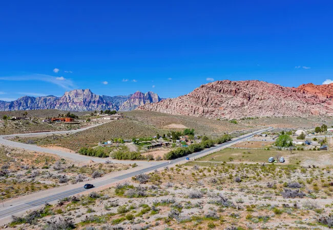
Red Rock Canyon National Conservation Area in Las Vegas, Nevada, is one of the most spectacular places on Earth.
Although its address is within the same city as the noisy, crowded strip that tends to steal all the attention, Red Rock Canyon is a landscape surrounded by vivid sandstone formations and the soaring La Madre and Spring mountains.
Visiting downtown Las Vegas without driving 25 minutes west to Red Rock Canyon is a great disservice.
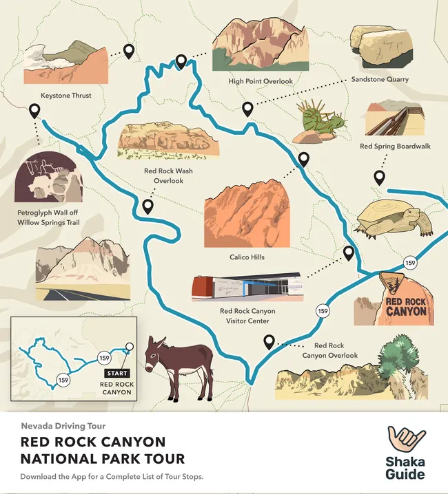
The main attraction at Red Rock Canyon is its one-way, 13-mile Scenic Drive. You must make an online reservation and pay an entrance fee (or use your National Park Pass).
This is thoroughly worthwhile, highly recommended, and features two stops and several trailheads in the Calico Hills.
But there’s another gem of a hike you can take without a reservation or entrance fee. It takes you along the other side of the Calico Hills. It’s called the Calico Basin Trail.
 Shutterstock Image
RELATED: Know Before You Go: Red Rock Canyon
About Calico Basin Trail
Calico Basin Trail begins from the Red Spring Picnic Area inside Red Rock Canyon National Conservation Area.
The hike is rated easy. It’s a 1.5-mile, round trip, out-and-back trail along the base of the Calico Hills.
It will take you about an hour to hike…if you don’t stop to ‘play’ on the rocks or to ogle the climbers.
In the summer, you may be able to see water flowing from Calico Spring and Red Spring, as well as lots of plants like cottonwood trees, shrub live oak, and honey mesquite.
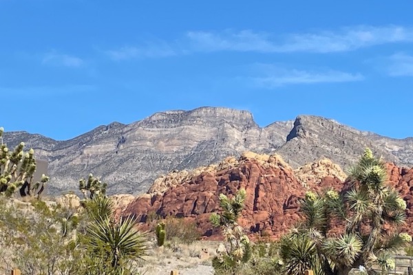
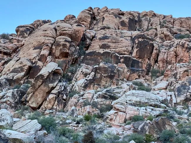
The red rock formations are so close you can reach out and touch them. You'll miss out if you go to downtown Las Vegas but don't drive the 25 minutes west to Red Rock Canyon. Not bad…for the driest desert in America!
 Shutterstock Image
RELATED: Red Rock Canyon: 10 Things To Do + 4 Things To Know
How to Get to Calico Basin (and Some Cool Things You’ll See on The Way)
The drive from Las Vegas to Calico Basin takes about 25 minutes. Plan to take Route 159/West Charleston Boulevard to stop at one of Albertson’s grocery stores.
I like the one in Summerlin, closest to Red Rock Canyon, at the corner of Desert Foothills Drive. Pick up a disposable cooler, lunch and snack items, plenty of water bottles, and a bag or two of ice.
If you’re planning to do the whole Red Rock Canyon Scenic Drive either before or after the Calico Basin hike, be sure and top off your gas tank at this location, too.
Because there’s no place to get food, water, or gas once you reach Red Rock Canyon.
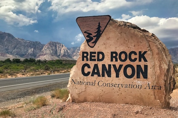
As you continue along West Charleston Blvd/Rt. 159 past the Vegas/Summerlin city limits, you’ll pass the giant Red Rock Canyon rock sign.
Pull in for a selfie! Then turn right onto Calico Basin Road, which is the turn before the main entrance to Red Rock Canyon.
Take Calico Basin Road straight down until you hit the Red Spring Picnic Area. Parking is free and there are restrooms, picnic tables and fire grills here.
Along with another hiking option – the Calico Overlook trail, and the Red Spring Boardwalk.
Located behind the picnic area, this raised boardwalk overlooks the Saltgrass meadows and marshy grassland with the Calico Hills as its backdrop.
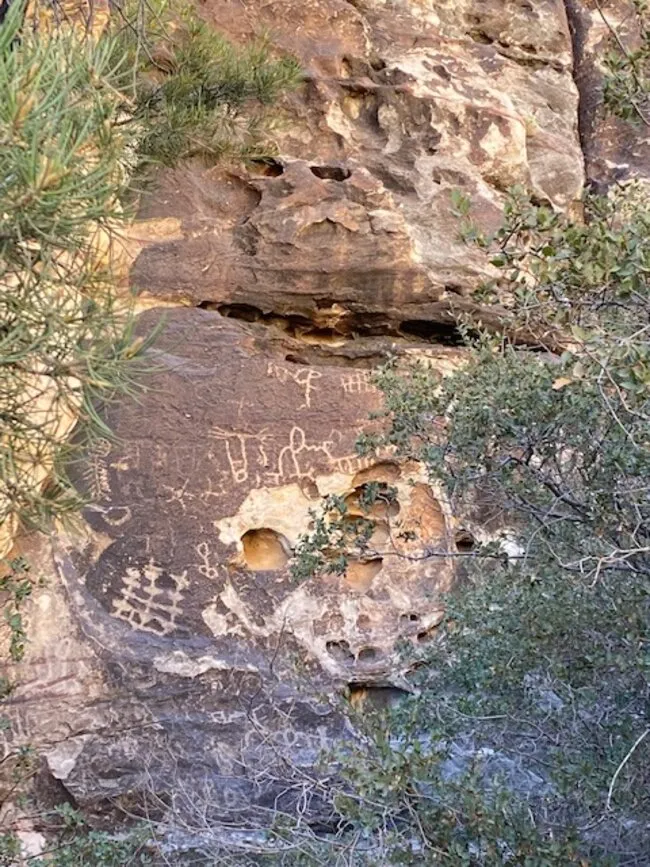
Keep your eyes out for petroglyphs…you’ll be able to spot some 800-year-old ancient artwork on the rocks here in the Calico Basin!
RELATED: The Ultimate Red Rock Canyon Travel Guide
Tips for Visiting Calico Basin
Be sure to slather on sunscreen, and wear lightweight, breathable high-top hiking boots. There’s slick rock along this trail, and hidden burrs in the brush that’ll snag and scratch your ankles.
This is the Mojave Desert, after all, so it’s best to avoid getting pricked by cacti. Another reason I recommend high-top hiking boots is because you’ll be moving among uneven rocks. So, the additional ankle stability and support is helpful.

Although finding a wifi signal at Red Rock Canyon is akin to winning a million bucks on a slot machine downtown, make sure your phone’s fully charged for another reason – because you’ll want to take photos.
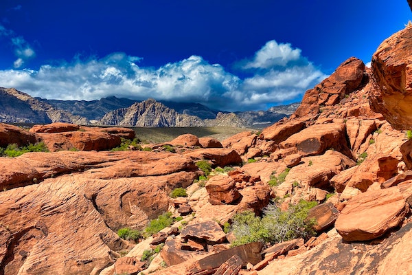
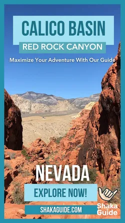
The Calico Hills are a mosaic of vivid colors from rust to copper, oranges to reds. You will see rocks formed in some of the most incredible shapes ever. It’s indescribable, really.
Hiking the Calico Basin Trail
 Shutterstock Image
If you’re standing in the parking lot facing the picnic area/boardwalk, the Calico Basin Trail will be to your right. There’s a big sign. From here, the 1.5-mile trail is yours to enjoy.
You’ll pass the impressive Cannibal Crag and cliffs, popular among rock climbers. To watch them scale those soaring rock walls will leave you marveling at just how high up they’re able to climb!
Once you reach the junction of the Girl Scout Trail, which leads to the Kraft Mountain Trail, you’ve arrived at Guardian Angel Canyon and the end of the Calico Basin Trail.
If you’re brave and skilled, you can explore the terrain by scrambling along the red rocks as if they’re your own personal jungle gym. But be careful…and cautious! This is only for the experienced.
Therefore, enjoy yourself, follow the numerous trail markers, be cautious of slick rock if it has rained recently, and allow yourself time to stop and take in the surroundings.
The Calico Hills rival any of the most gorgeous places on this planet, and the Calico Basin Trail is one of my favorite ways to experience Red Rock Canyon.
Visiting Las Vegas? Check out the Las Vegas Tour Bundle with self-guided driving tours of Red Rock Canyon and Hoover Dam & Lake Mead!
We hope that we’ve given you all the information you need to make the most of your day. Your vacation is extremely important to us so if you have any questions feel free to reach out at aloha@shakaguide.com.
For more detailed information to help you plan, check out our Red Rock Canyon Itinerary and Know Before You Go article.
Like this article? Share it on Pinterest!
Visiting Las Vegas? Check out the Las Vegas Tour Bundle with self-guided driving tours of Red Rock Canyon and Hoover Dam & Lake Mead!
RELATED ARTICLES:
The Ultimate Red Rock Canyon Travel Guide

 Buy Gift Card


