


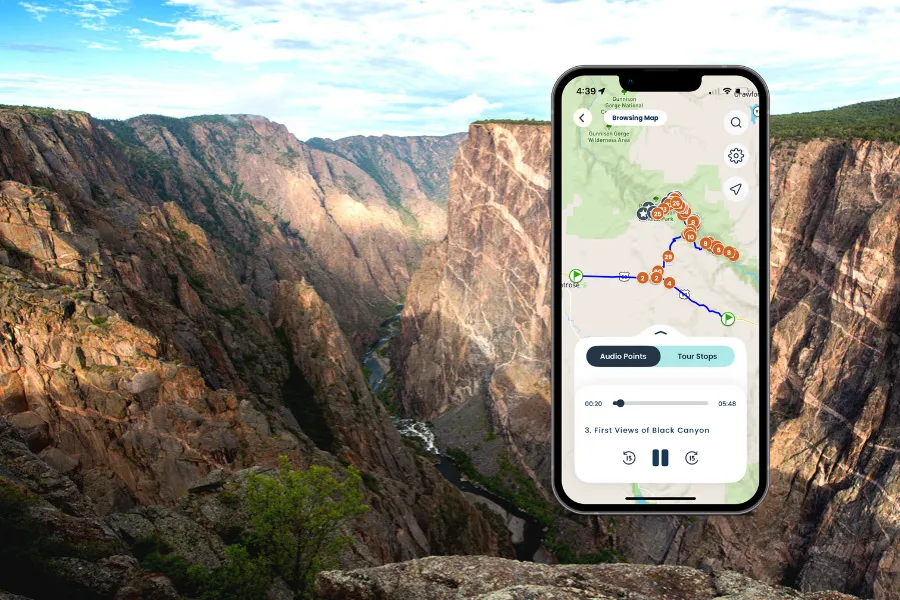
 Preview Tour Audio


Like a trusty car and a full tank of gas, these cookies keep everything running smoothly. They power core features like secure login, navigation, and yo

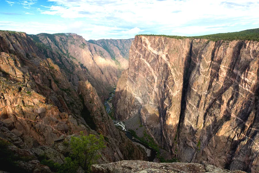
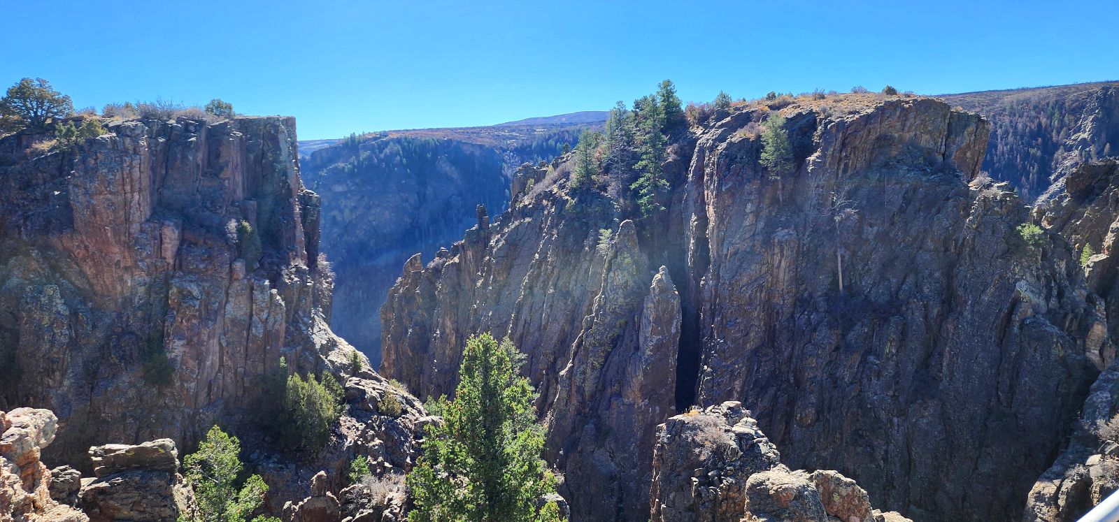
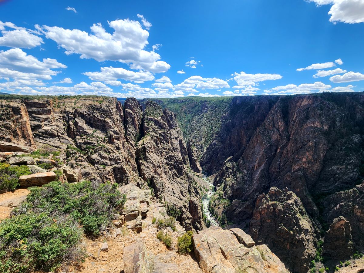
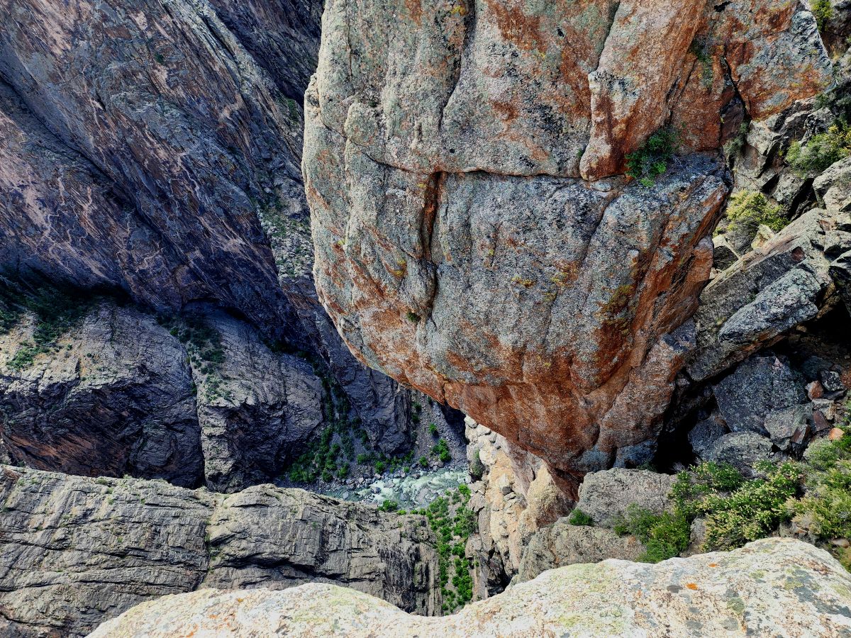
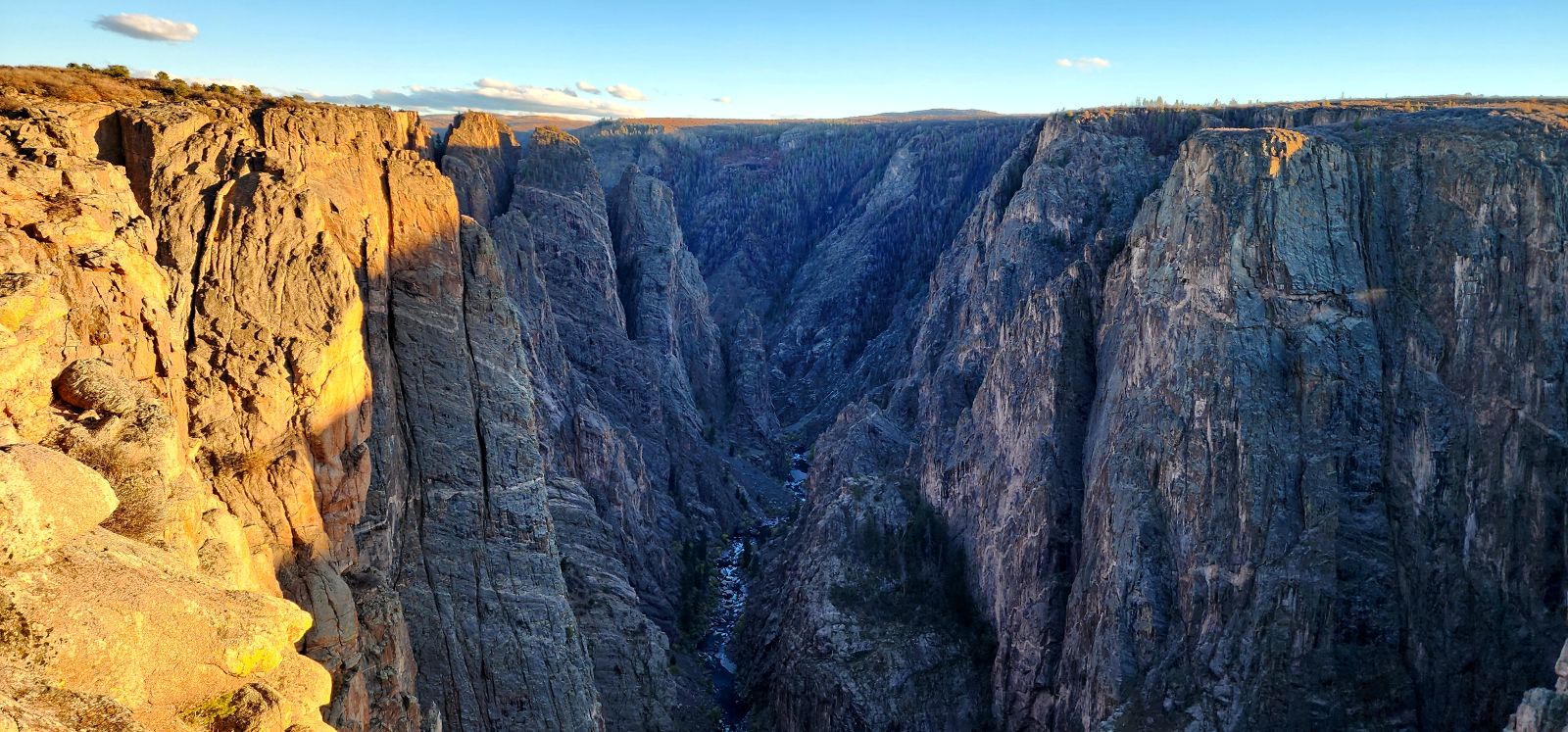
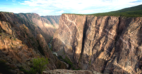
Black Canyon of the Gunnison Tour
 Colorado
$9.99
Black Canyon of the Gunnison Tour
Colorado
4.9
77462 ratings


About The Tour
***PARK ACCESS IMPACTED BY SOUTH RIM FIRE.***
Both the South Rim and East Portal areas were affected by recent fires, but have since reopened to visitors (weather permitting). Some trails and services may still be limited as crews continue repairs and the landscape begins to recover.
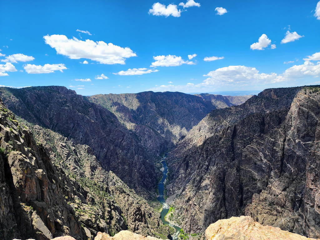
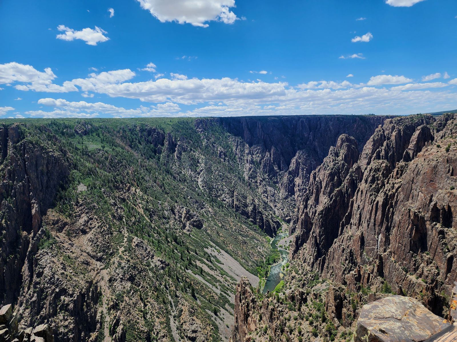
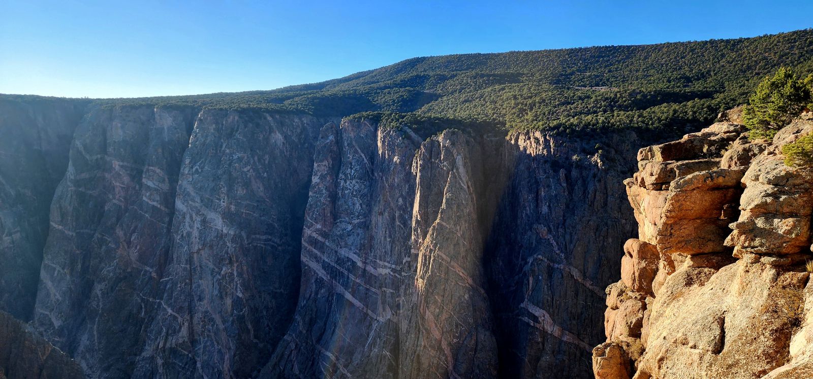
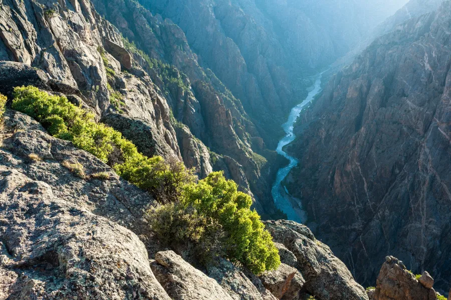
Are you ready to step back in time? Travel through the depths of Black Canyon, where sheer cliffs and roaring waters hold stories of daring explorers, heartbreaking struggles, and astonishing feats of engineering.
Experience it all along the breathtaking heights of Rim Drive and the dramatic depths of East Portal Road.
Here are just a few of the fun things you can do on the tour!
• Watch the sun dip behind cliffs at the peaceful Sunset View overlook.
• Stand at Gunnison Point for dramatic views of the canyon’s steep walls.
• Stop at Dragon Point to spot dark volcanic rock among canyon layers.
• Look deep into the gorge from Chasm View’s thrilling rocky edge.
• Drive to Gunnison East Portal for riverside views and picnic spots.
• Take a scenic drive to the remote North Rim and experience the rim less traveled.
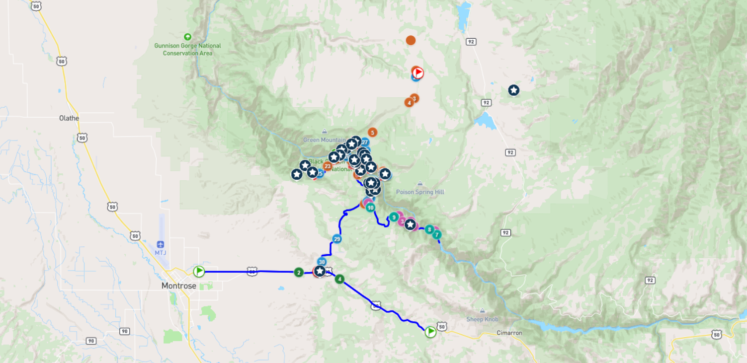
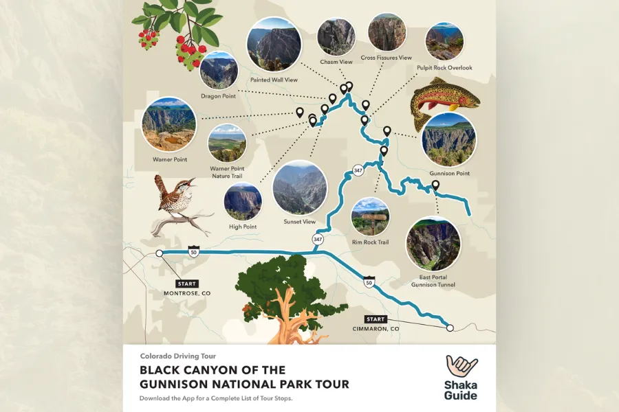
Black Canyon of the Gunnison Tour Stops
Things to do on the Tour Include:
- Dragon Point
- Deadhorse Trail
- Kneeling Camel View
- Island Peaks View
- Big Island View
- Balanced Rock View
- The Narrows View
- Chasm View Nature Trail
See More
Meet the Creators

Rachel Ennis
Narrator
I’ll be your guide on this tour. Press play to hear a sneak peek of the stories waiting for you as you browse.
Black Canyon of the Gunnison Tour FAQS
Inclusions:
- More than a map and directions — your tour, fully guided
- Audio storytelling that plays as you drive
- Music and immersive sound to upgrade your drive
- Human-created, professionally narrated tours
- Pre-planned route with turn-by-turn directions
- Itinerary mapped out with must-see stops
- Expert travel tips
- Offline access – works without data or wifi
- Flexible, self-paced experience
- One purchase per vehicle (not per person)
- Lifetime access (tours never expire)
- Reliable customer support
Exclusions:
- Private transportation (use your own or rental vehicle)
- Meals
- Attraction admission or park entrance fees
- Parking fees
- Live tour guide or in-person services
- Trip planning or booking services
- Fully customizable navigation like Google or Apple Maps
- On-demand route planning or custom directions
- Open-ended navigation tools
- Layered clothing
- Bug Spray
- Lots of Water
- Long Pants (for inner canyon hikes)
How much you spend truly depends on what you do along the tour route.
All wilderness hikes for the Black Canyon of the Gunnison National Park require a wilderness use permit, including day hikes. (Some examples are Tomichi, Gunnison, and Warner.)
They can be obtained on Recreation.gov in advance or at the visitor center the day before.
The tour stops have seasonal hours of operation. The site’s facilities and restaurants also have varying hours of operation.
- Black Canyon General Store:
- Monday-Saturday 11:00 AM - 5:00 PM
- Sunday 1:00 PM - 5:00 PM
The park itself is open 24 hours a day.
However, tour stops have seasonal hours of operation, with most of the canyon's roads closing in winter. The site’s facilities and restaurants also have varying hours of operation, generally maintaining standard business hours.
No, the tour is one-way.
Yes, you can join along the route. You’ll miss a few stories, but you’ll still have a great time!
Most park roads are accessible to passenger vehicles. However, vehicles over 22 feet are prohibited on East Portal Road, and large RVs or trailers are not recommended on the North Rim’s narrow gravel road. Seasonal snow closures also affect North Rim access.
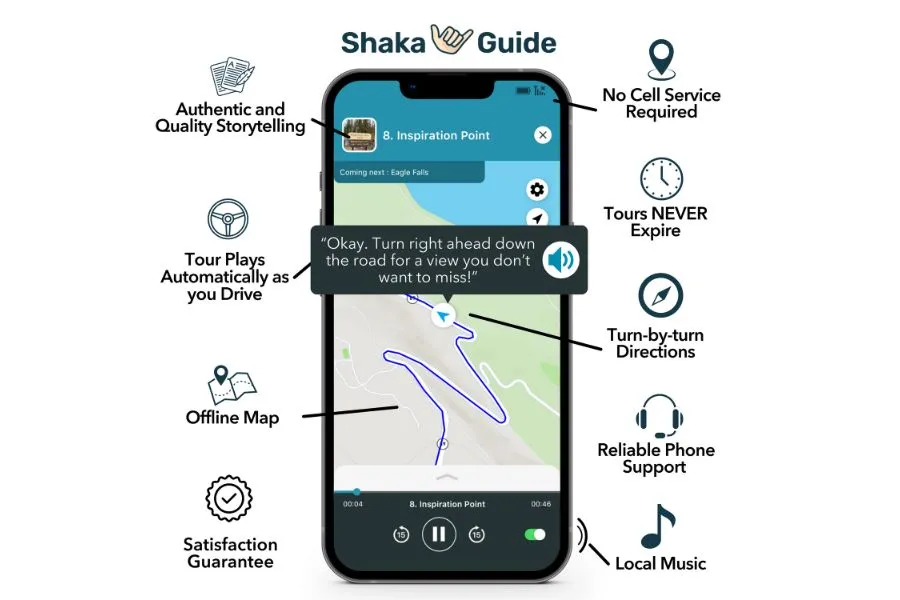
Shaka Guide isn’t just about getting from point A to point B — it’s like having a tour guide in your car, sharing stories and local insights as you drive. Unlike other navigation apps, we’ve planned the route for you, so instead of focusing on directions, you can focus on the experience. This means you can’t customize the route, but that’s kind of the point. You’re still in control though, you can skip stops, go at your own pace, and explore freely. It’s not just about getting there; it’s about enjoying the journey.
Still have questions? Send us an email at aloha@shakaguide.com or give us a call at (808) 201-8138.
Think of us as your personal tour guide in an app. Our tours provide everything a guided tour does, but with the freedom to explore on your terms. Here’s how it works:
- GPS triggers audio narration to play automatically as you drive or walk. Listen to stories, get local insights, visit must-see stops and get turn-by-turn navigation.
- The app works offline so even with spotty service we’ll get you where you need to go.
Pretty cool huh? We think so! Check out our tours and let’s explore together.
Purchase Options
This Tour Only

1.
Black Canyon of the Gunnison Tour
$ 9.99
Bundle & Save (76% Off)
2.
The Ultimate National Park Tour Collection
-
 1. Hawaii Volcanoes National Park Tour$ 22.99
 -
 2. Sunrise at Haleakala National Park Tour$ 19.99
 -
 3. Sunset and Stargazing Haleakala Tour$ 19.99
 -
 4. Arches National Park Tour$ 15.99
 -
 5. Zion National Park Tour$ 14.99
 -
 6. Capitol Reef National Park Tour$ 18.99
 -
 7. Bryce Canyon National Park Tour$ 14.99
 -
 8. Canyonlands National Park Tour$ 15.99
 -
 9. Grand Canyon South Rim Tour$ 16.99
 -
 10. Petrified Forest National Park Tour$ 14.99
 -
 11. Saguaro National Park Tour$ 14.99
 -
 12. Grand Canyon North Rim Tour$ 19.99
 -
 13. Rocky Mountain National Park Tour$ 15.99
 -
 14. Joshua Tree National Park Tour$ 15.99
 -
 15. Yellowstone National Park Tour$ 18.99
 -
 16. Yosemite National Park Tour$ 16.99
 -
 17. Grand Teton National Park Tour$ 14.99
 -
 18. Death Valley National Park Tour$ 15.99
 -
 19. Mount Rainier National Park Tour$ 16.99
 -
 20. Shenandoah National Park Tour$ 15.99
 -
 21. Great Smoky Mountains National Park Tour$ 15.99
 -
 22. Cuyahoga Valley National Park Tour$ 18.99
 -
 23. New River Gorge National Park Tour$ 15.99
 -
 24. Redwood National Park Tour$ 16.99
 -
 25. Sequoia National Park Tour$ 11.99
 -
 26. Kings Canyon National Park Tour$ 11.99
 -
 27. Big Bend National Park Tour$ 15.99
 -
 28. Everglades National Park Tour$ 15.99
 -
 29. White Sands National Park Tour$ 15.99
 -
 30. Indiana Dunes National Park Tour$ 19.99
 -
 31. Olympic National Park Tour$ 18.99
 -
 32. Crater Lake National Park Tour$ 18.99
 -
 33. Acadia National Park Tour$ 15.99
 -
 34. Lassen Volcanic National Park Tour$ 15.99
 -
 35. North Cascades National Park Tour$ 15.99
 -
 36. Badlands National Park Tour$ 15.99
 -
 37. Theodore Roosevelt National Park Tour$ 18.99
 -
 38. Mesa Verde National Park Tour$ 15.99
 -
 39. Glacier National Park Tour: Going-to-the-Sun Road$ 9.99
 -
 40. Great Basin National Park$ 19.99
 -
 41. Hot Springs National Park$ 15.99
 -
 42. Glacier National Park Tour: Many Glacier$ 9.99
 -
 43. Glacier National Park Tour: Two Medicine$ 9.99
 -
 44. Gateway Arch National Park$ 14.99
 -
 45. Glacier National Park Tour: North Fork$ 9.99
 -
 46. Guadalupe Mountains National Park$ 14.99
 -
 47. Carlsbad Caverns National Park$ 14.99
 -
 48. Biscayne National Park Tour$ 14.99
 -
 49. Wind Cave National Park Tour$ 9.99
 -
 50. Great Sand Dunes National Park Tour$ 9.99
 -
 51. Black Canyon of the Gunnison Tour$ 9.99
 -
 52. Reverse Arches National Park Tour$ 15.99
 -
 53. Dry Tortugas National Park Tour$ 12.99
 -
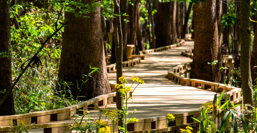 54. Congaree National Park Walking Tour$ 12.99
$ 199.99
$847.46
Reviews
- Dschaff
- 02 Jun 2026
Rachel was a great tour guide for the Black Canyon of the Gunnison audio tour. Not only did she hold our interest but she shared many stories about the area. We haven’t been disappointed with the Shaka Guided tours yet. Thank you for a great tour.
Tours Near Black Canyon of the Gunnison Tour

La Sal Mountain Loop
Mesa Verde National Park Tour
Reverse Arches National Park Tour
Arches National Park Tour
Canyonlands National Park Tour
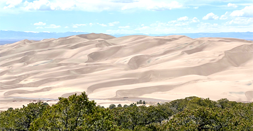
Great Sand Dunes National Park Tour

The Road to Monument Valley Tour

Goblin Valley State Park Tour

Monument Valley Tour
Rocky Mountain National Park Tour
Purchase Options
This Tour Only
1.
Black Canyon of the Gunnison Tour
$ 9.99
Bundle & Save (76% Off)
2.
The Ultimate National Park Tour Collection (54 tours)
$ 199.99
$847.46
-
1. Hawaii Volcanoes National Park Tour$ 22.99
-
2. Sunrise at Haleakala National Park Tour$ 19.99
-
3. Sunset and Stargazing Haleakala Tour$ 19.99
-
4. Arches National Park Tour$ 15.99
-
5. Zion National Park Tour$ 14.99
-
6. Capitol Reef National Park Tour$ 18.99
-
7. Bryce Canyon National Park Tour$ 14.99
-
8. Canyonlands National Park Tour$ 15.99
-
9. Grand Canyon South Rim Tour$ 16.99
-
10. Petrified Forest National Park Tour$ 14.99
-
11. Saguaro National Park Tour$ 14.99
-
12. Grand Canyon North Rim Tour$ 19.99
-
13. Rocky Mountain National Park Tour$ 15.99
-
14. Joshua Tree National Park Tour$ 15.99
-
15. Yellowstone National Park Tour$ 18.99
-
16. Yosemite National Park Tour$ 16.99
-
17. Grand Teton National Park Tour$ 14.99
-
18. Death Valley National Park Tour$ 15.99
-
19. Mount Rainier National Park Tour$ 16.99
-
20. Shenandoah National Park Tour$ 15.99
-
21. Great Smoky Mountains National Park Tour$ 15.99
-
22. Cuyahoga Valley National Park Tour$ 18.99
-
23. New River Gorge National Park Tour$ 15.99
-
24. Redwood National Park Tour$ 16.99
-
25. Sequoia National Park Tour$ 11.99
-
26. Kings Canyon National Park Tour$ 11.99
-
27. Big Bend National Park Tour$ 15.99
-
28. Everglades National Park Tour$ 15.99
-
29. White Sands National Park Tour$ 15.99
-
30. Indiana Dunes National Park Tour$ 19.99
-
31. Olympic National Park Tour$ 18.99
-
32. Crater Lake National Park Tour$ 18.99
-
33. Acadia National Park Tour$ 15.99
-
34. Lassen Volcanic National Park Tour$ 15.99
-
35. North Cascades National Park Tour$ 15.99
-
36. Badlands National Park Tour$ 15.99
-
37. Theodore Roosevelt National Park Tour$ 18.99
-
38. Mesa Verde National Park Tour$ 15.99
-
39. Glacier National Park Tour: Going-to-the-Sun Road$ 9.99
-
40. Great Basin National Park$ 19.99
-
41. Hot Springs National Park$ 15.99
-
42. Glacier National Park Tour: Many Glacier$ 9.99
-
43. Glacier National Park Tour: Two Medicine$ 9.99
-
44. Gateway Arch National Park$ 14.99
-
45. Glacier National Park Tour: North Fork$ 9.99
-
46. Guadalupe Mountains National Park$ 14.99
-
47. Carlsbad Caverns National Park$ 14.99
-
48. Biscayne National Park Tour$ 14.99
-
49. Wind Cave National Park Tour$ 9.99
-
50. Great Sand Dunes National Park Tour$ 9.99
-
51. Black Canyon of the Gunnison Tour$ 9.99
-
52. Reverse Arches National Park Tour$ 15.99
-
53. Dry Tortugas National Park Tour$ 12.99
-
54. Congaree National Park Walking Tour$ 12.99

Shaka Promises
Shaka Promises
Tours Crafted by
Real People
Reliable Customer
Support
Satisfaction
guaranteed
Black Canyon of the Gunnison Tour
$9.99
The Ultimate National Park Tour Collection
$199.99
-
Hawaii Volcanoes National Park Tour
-
Sunrise at Haleakala National Park Tour
-
Sunset and Stargazing Haleakala Tour
-
Arches National Park Tour
-
Zion National Park Tour
-
Capitol Reef National Park Tour
-
Bryce Canyon National Park Tour
-
Canyonlands National Park Tour
-
Grand Canyon South Rim Tour
-
Petrified Forest National Park Tour
-
Saguaro National Park Tour
-
Grand Canyon North Rim Tour
-
Rocky Mountain National Park Tour
-
Joshua Tree National Park Tour
-
Yellowstone National Park Tour
-
Yosemite National Park Tour
-
Grand Teton National Park Tour
-
Death Valley National Park Tour
-
Mount Rainier National Park Tour
-
Shenandoah National Park Tour
-
Great Smoky Mountains National Park Tour
-
Cuyahoga Valley National Park Tour
-
New River Gorge National Park Tour
-
Redwood National Park Tour
-
Sequoia National Park Tour
-
Kings Canyon National Park Tour
-
Big Bend National Park Tour
-
Everglades National Park Tour
-
White Sands National Park Tour
-
Indiana Dunes National Park Tour
-
Olympic National Park Tour
-
Crater Lake National Park Tour
-
Acadia National Park Tour
-
Lassen Volcanic National Park Tour
-
North Cascades National Park Tour
-
Badlands National Park Tour
-
Theodore Roosevelt National Park Tour
-
Mesa Verde National Park Tour
-
Glacier National Park Tour: Going-to-the-Sun Road
-
Great Basin National Park
-
Hot Springs National Park
-
Glacier National Park Tour: Many Glacier
-
Glacier National Park Tour: Two Medicine
-
Gateway Arch National Park
-
Glacier National Park Tour: North Fork
-
Guadalupe Mountains National Park
-
Carlsbad Caverns National Park
-
Biscayne National Park Tour
-
Wind Cave National Park Tour
-
Great Sand Dunes National Park Tour
-
Black Canyon of the Gunnison Tour
-
Reverse Arches National Park Tour
-
Dry Tortugas National Park Tour
-
Congaree National Park Walking Tour
3 Steps to Buy & Redeem:
Add to Cart & Checkout
Create Account during checkout
Download App & Login

Join the Ride!
Our next stop - your inbox! Subscribe to our email list for travel tips, inspiration, special offers, and more!
About Us
At Shaka Guide our goal is to connect people, with places, through stories. Our team creates immersive, self-guided audio tours that connect travelers with the history and culture of over 85 destinations across the country.


© Shaka Guide LLC 2026
We use cookies  to fuel your ride
We use cookies to fuel
your ride